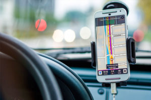
 GeoPro has the expertise to handle end to end map data development, maintenance and enhancement, from specifications creation to actual production. We have proven experience of working on large map data projects that require significant ramp up and training within a short turnaround time. Key solutions include:
- Consultancy and specifications creation
- Image processing & interpretation
- Digital cartography
- Street network digitization & realignment
- Attribute & road sign capture
- Building 3D landmarks & models
- Mobile video mapping & field data collection
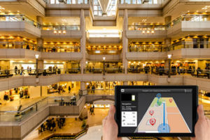 GeoPro provides indoor venue map data creation and maintenance services to indoor positioning application providers, map data providers, and large retail chains, amongst others. We create and convert indoor venue map data from multiple resources, (CAD/PDF) following AVF (Apple Venue Format) standards.
We help our clients in creating a unique ‘in-store’ navigation experience for their customers and in accurately guiding them to various points of interest within the venue. Our team of experts have an in-depth understanding of different types of indoor venues such as airports, museums, stadiums, stores, malls, hospitals, etc. Key steps include:
- Geo-referencing of floor plans
- Capturing of sub-structures within each level, such as rooms, elevators, escalators & stairs
- Capturing of immovable architectural features and other structures within a level such as walls, doorways, and shelving units.
- Building topology & logical connectivity of indoor features
- Capturing of attributes from floor plans, visitor maps, directories, etc
- Internet research to add additional attributes such as opening hours, phone numbers & any other client specified details
- Data delivery in client compatible formats